|
Contrary to most beliefs, you don't need an expensive GPS for kayaking as some of the features are only correct if the GPS is always kept on and in kayaking, that is not the case. If you are only paddling for
 a day trip, you might keep the GPS on while continuously paddling, but in most situations, you are concerned about the life of the batteries. A GPS never replaces good navigational skills and never replaces a real map. You must always carry a map and know how to read the map. A GPS doesn't know about all the outside factors that might be occurring: tide changes, rough seas, changing weather conditions, etc. It is the knowledge of all factors, along with the use of a GPS, that makes your trip safe.
Kayak speed and distance
The average speed of the kayak can only be determined if the GPS is on at all times. Otherwise, you must do the calculation yourself. (And they are both only partially correct). If you have the GPS on at all times and you stop for a while, the calculation of average speed would be incorrect. If you paddle in a Z shaped pattern, mark a waypoint at the start of the Z, turn the GPS off, paddle to the end of the Z, mark a waypoint and then calculate the distance between the two waypoints, the GPS will indicate that you paddled 1/2 mile. The GPS does NOT know that you didn't paddle in a straight line. You would have to mark 4 waypoints (each time you turned and then measure the distance between the 4 waypoints and then the GPS would record 1 mile). The GPS only gives the correct distance and speed if the GPS is left on all the time and there is constant paddling or each time the kayak goes into a different direction, each waypoint is marked.
Currents, tides and wind
The GPS does not know if the tide, currents or wind is a factor in the paddling. You might be paddling at 3 1/2 knots and maybe there is a tide of 1 knot directly in the direction you are paddling or directly against you. In the first situation, your paddling speed would be 2 1/2 knots and the second example your paddling speed would be 4 1/2 knots. The GPS would give you the correct kayak speed, but not your correct paddling stroke speed. If you had 4 miles to paddle and you figured your speed at 4 1/2 knots but the tide is now against you, the calculated arrival time based on the GPS would be inaccurate. You would have calculated maybe about 50 minutes and now it might be 1 hour and 15 minutes due to the tide change. You must be aware of all factors and when the GPS could possibly give incorrect information.
Pre trip planning
If you enter the waypoints into the GPS before you set out on a trip (using GPS software or manually entering the waypoints), it becomes a very helpful tool. A few times I have been fogged in and paddled the last 2 miles with my GPS and compass and have arrived exactly where I wanted to be. The GPS is extremely helpful in those situations. I have paddled where there is a 9 foot tide and sand bars emerging all around you due to low tide. If there is a channel that you need to find during low tide, the GPS is very useful for those specially marked waypoints that were marked in your last trip there.
Marking waypoints
If you paddle to certain places and you want to remember exactly how to get back, the GPS is very valuable for marking waypoints. Just hit the waypoint button, name it, add a short description and you will always return to the same place next time.
Rescue or emergencies
The GPS is extremely useful in giving the exact location of where you are located in case of an emergency.
Meeting your friends
If you are going to meet your friends at a certain waypoint, you will be assured that everyone will meet at the right place.
Coordination with a map
Many helpful waypoints such as a lighthouse, a boat launch, a wreck, a buoy, etc. will indicate exactly where you are and will help locating your position on a real map. If the GPS indicates that you are 1/4 mile away from a specific buoy, you will be able to see exactly where you are on a paper map.
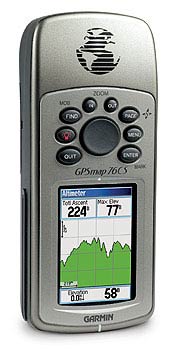
I have an older version that has only waypoints on the screen (no mapping was available at the time I purchased my GPS) and the waypoints are the most important feature regarding a GPS. All the other features are great, but sometime impractical. Plot your course on GPS software, download the waypoints into your GPS, bring a real map along and that is really all you need to use a GPS for while kayaking.
|